Access my research papers, open-source projects, and datasets related to geospatial research on climate change, energy transition, and natural capital.
GitHub Repositories
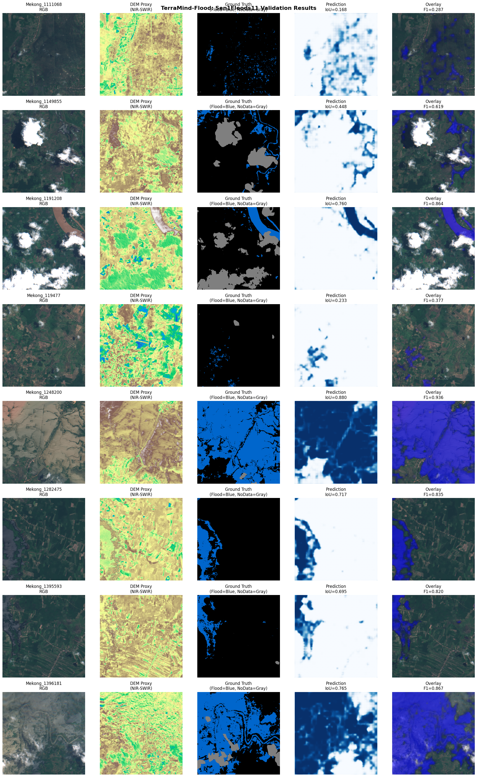
terramind-flood
Python
AI-powered flood prediction and risk assessment using geospatial data. Combines satellite imagery, terrain analysis, and machine learning for early warning systems.
Volcanic eruption risk assessment and hazard mapping using remote sensing data, thermal imagery analysis, and geospatial modeling for disaster preparedness.
Revealing the hidden environmental cost of mining operations at Grasberg Mine, Indonesia. Quantifying ecosystem destruction, carbon loss, and economic trade-offs.