My Work
A collection of geospatial projects spanning GIS analysis, remote sensing, and geodetic surveys.
Geographic Information Systems
Spatial data analysis, mapping, and geographic visualization solutions for mining and environmental projects.
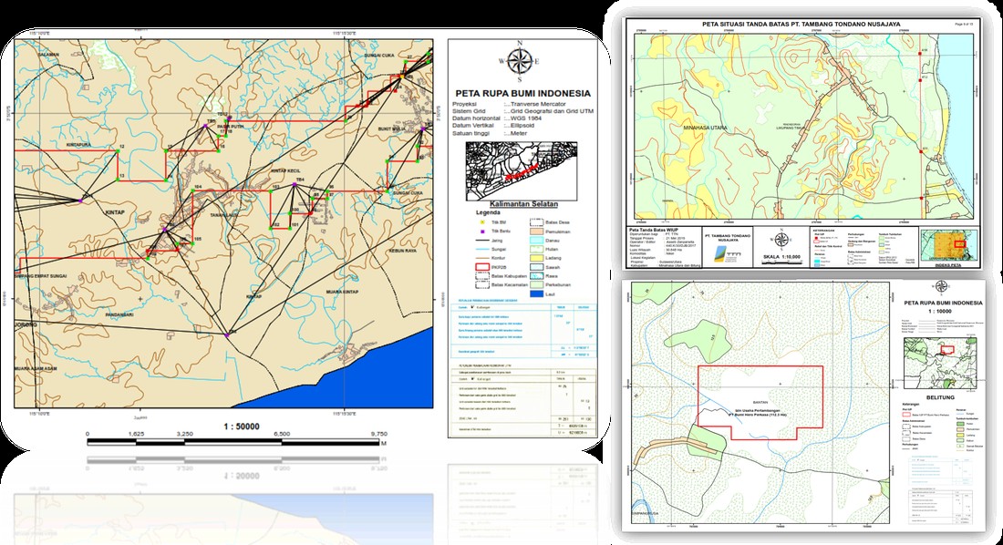
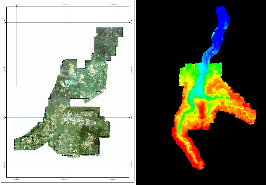
A mining lease boundary map across multiple projects.
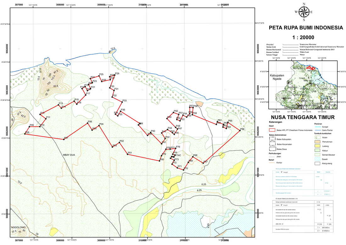
A topographic map showcasing the salt lands of East Nusa Tenggara.
Remote Sensing
Satellite imagery analysis, spectral processing, and earth observation applications for environmental monitoring.
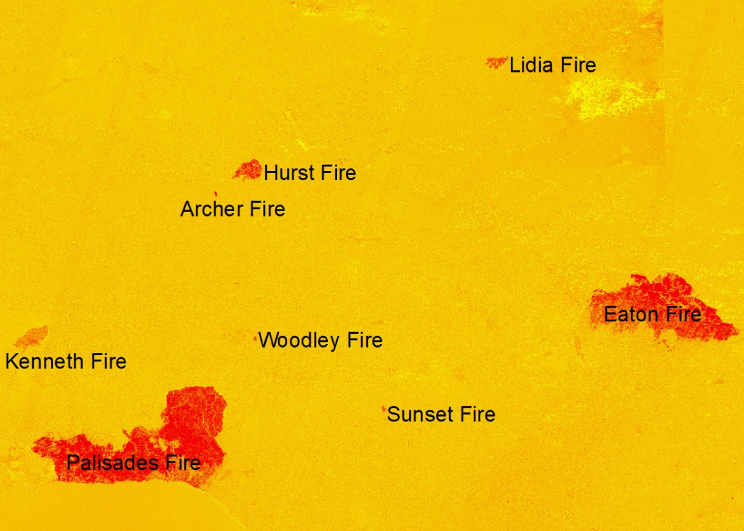
Analysis of fire hotspot detection in the wildfire event in Los Angeles, early 2025.
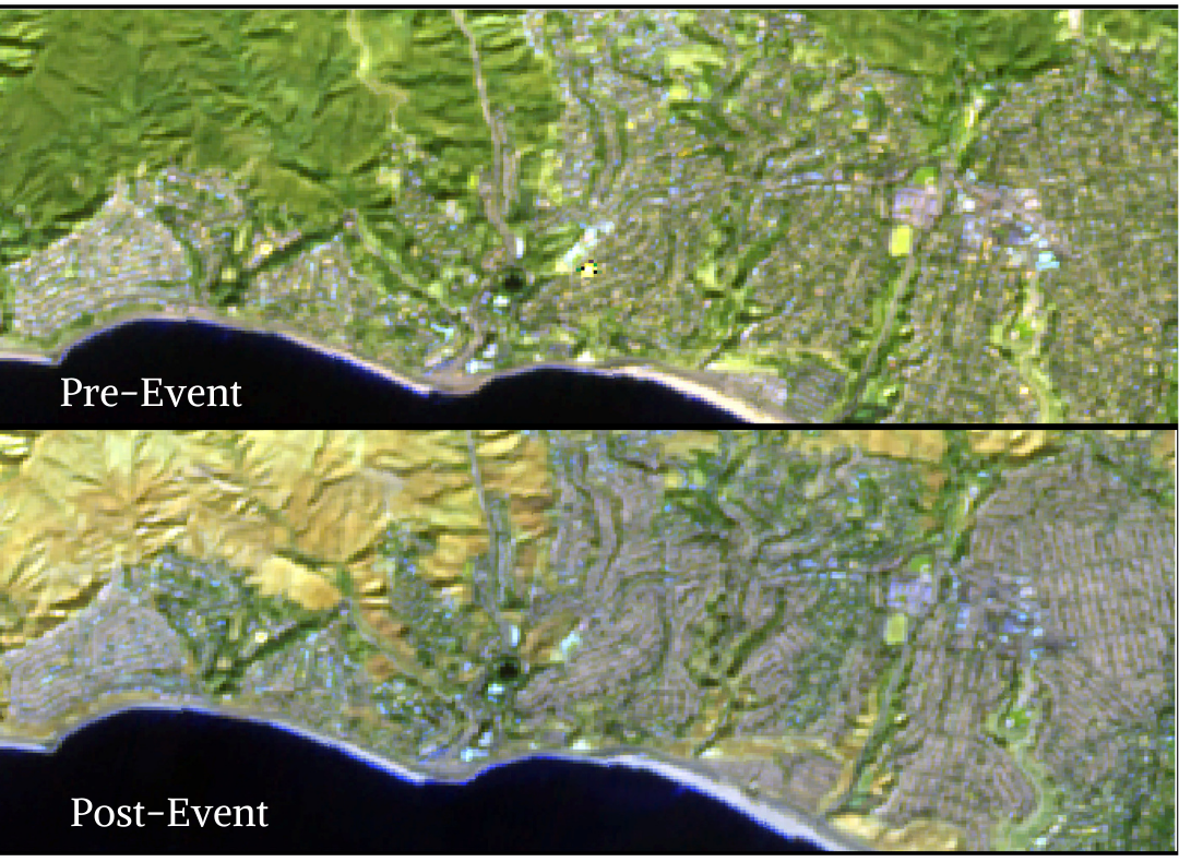
Pre- and post-event analysis using Normalized Burn Ratio (NBR).
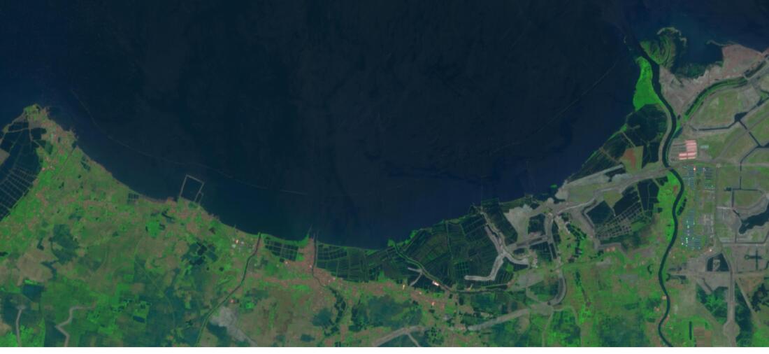
RGB satellite imagery of northern Jakarta coast in natural color.
Geodesy
Precise positioning, bathymetric surveys, and geospatial measurements for infrastructure and marine projects.
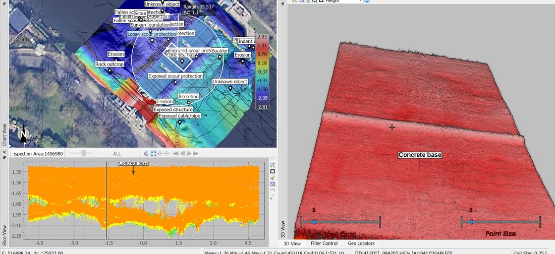
Bathymetric mapping using MBES to detect pipelines in London waters.
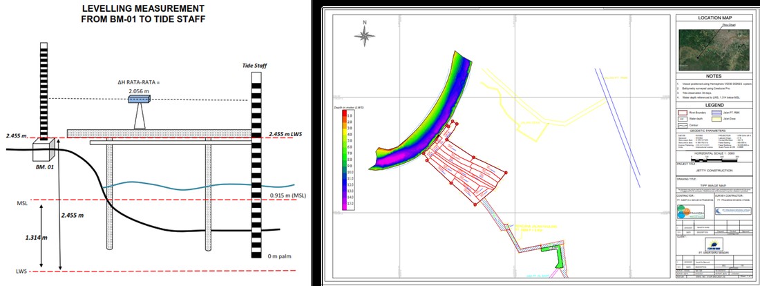
Bathymetric survey for port construction in Musi River, South Sumatra.
Satellite imagery mosaic and Digital Elevation Model from drone LiDAR scanning.
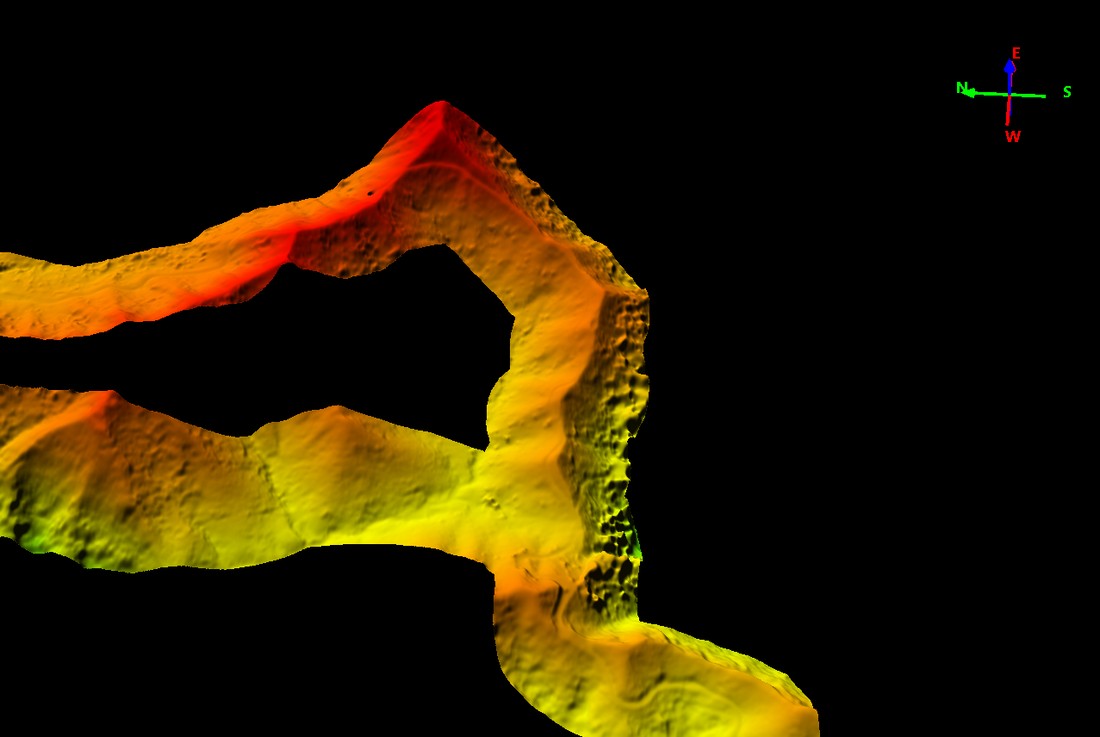
Digital Elevation Model derived from drone LiDAR scanning.
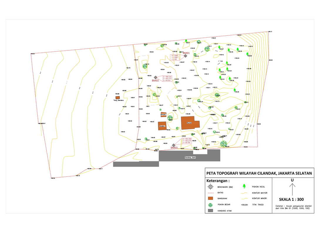
Fine scale topographic mapping for park development using total station.
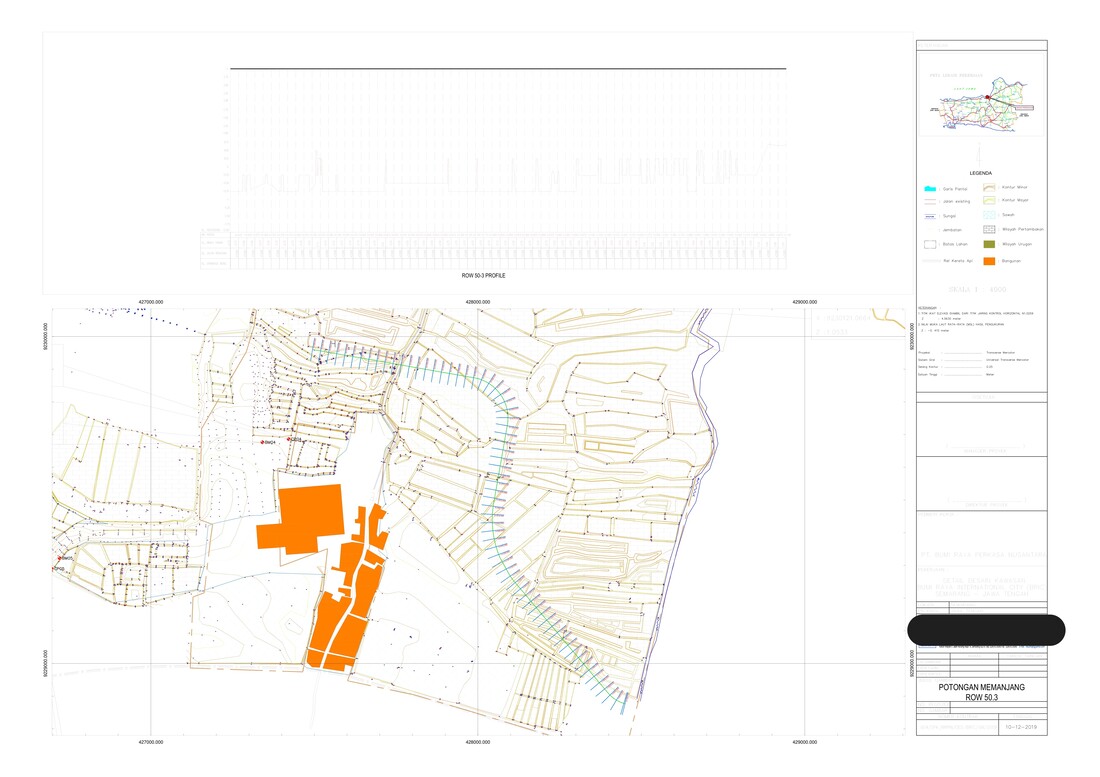
Cross and long sections from topographic mapping data.